
Key Takeaways
- Nanga Parbat rises 8,126 meters (26,660 feet) in Gilgit-Baltistan, Pakistan. It’s the ninth highest mountain in the world.
- Climbers call it the Killer Mountain. Thirty one people died on it before anyone reached the summit in 1953.
- The Rupal Face, about 4,600 meters tall, is often called the highest mountain wall on Earth.
- Hermann Buhl made the first ascent alone in 1953. A three man team made the first winter ascent in 2016.
- You don’t have to climb to see it. Fairy Meadows gives the classic view after a jeep ride and a hike. The season runs from April to October.
What Is Nanga Parbat?
Nanga Parbat is an 8,126 meter (26,660 feet) mountain in Gilgit-Baltistan, Pakistan. It’s the ninth highest peak on Earth and the western anchor of the Himalaya.
If still wondering about where is Nanga Parbat, exactly, it stands in the Diamer district of northern Pakistan. The Indus River curls around its base, near the spot where the Himalaya, Karakoram and Hindu Kush ranges meet. The Himalayan Journal describes it as the western end of the Himalayan crest.
Many websites place it in the Karakoram. That’s a common mistake. Nanga Parbat belongs to the Himalaya. The Karakoram lies farther north, across the Indus valley.
The name comes from Sanskrit and means “naked mountain.” Its steep south side often sheds snow and shows bare rock. Locals call the peak Diamer, from a Shina phrase that means “huge mountain.” Shina is a language spoken across the region.
Nanga Parbat isn’t one lone summit, either. It’s a long ridge with several peaks above 7,000 meters. An old valley legend even places a fairy queen on top, in a crystal castle guarded by ice dragons.
Why Is Nanga Parbat Called the Killer Mountain?
Climbers gave it that name because so many died trying to climb it. Thirty one people had died on its slopes before anyone stood on the summit.
Three things explain that record. The walls are huge and steep. Avalanches and sudden storms hit the upper slopes often. And the early expeditions had little experience with a mountain this big. They also worked without modern forecasts or light gear.
By most counts, about one climber has died for every five who reached the top, according to Global Summit Guide, which compiles Himalayan Database figures. That’s a high rate of danger, even among the 8,000 meter peaks.
But not everyone likes the nickname. One writer in the Himalayan Journal argues that mountains don’t kill people. She blames bad weather, mistakes and bad luck. She prefers “Mother Mountain,” because the peak feeds the valleys and villages below it.
The Three Great Faces of Nanga Parbat
Nanga Parbat has three main faces. The Rupal Face looks south, the Diamer Face looks northwest and the Raikhot Face looks northeast. Each one has its own story.
The Rupal Face: The Highest Mountain Wall on Earth
The Rupal Face rises about 4,600 meters (15,000 feet) from base to summit. Sources give figures between 4,500 and 4,600 meters, but nearly all call it the tallest mountain wall on Earth.
For years, this wall stopped every team that tried it. Reinhold and Günther Messner made the first climb in 1970. A team of Austrians led by Hanns Schell opened a straighter line in 1976. In 2005, Americans Steve House and Vince Anderson climbed a hard new route and carried everything themselves.
The Rupal valley lies on the opposite side from Fairy Meadows. The trip there takes more time, so far fewer visitors see this wall.
The Diamer Face
The Diamer Face is the northwest side. It’s less steep than the Rupal Face, and climbers have long used it for summit attempts.
Albert Mummery tried this side in 1895. In 1962, Toni Kinshofer, Siegi Löw and Anderl Mannhardt made the second ascent of the mountain here. Löw died on the way down. Their line is still known as the Kinshofer Route. Reinhold Messner soloed the mountain from this side in 1978.
The Raikhot Face: The One You See From Fairy Meadows
The Raikhot Face is the northeast side, and it’s the one you see from Fairy Meadows. It climbs about 7,000 meters from the Indus valley in roughly 27 kilometers. That’s one of the biggest elevation gains in the world.
You’ll see this name spelled Raikhot, Raikot and Rakhiot. They all mean the same side. Buhl’s team used this side in 1953, following a route first tried in 1934.
A History of Triumphs & Tragedies
Nanga Parbat’s story runs from a lost British attempt in 1895 to a winter first in 2016. By most counts, the mountain has taken about 70 to 85 lives along the way. Exact numbers vary, because sources count support staff and non climbing events differently.
Mummery and the early attempts
Albert Mummery, a British climber, made the first known attempt in 1895. He wanted to climb “by fair means,” which meant no pitons or artificial help. On August 24, he set out with two Gurkha men, Raghobir Thapa and Gaman Singh. Nobody saw any of them again.
German teams took over in the 1930s. In 1934, Alfred Drexel died of illness. A storm then killed Willy Merkl, Willo Welzenbach, a climber named Wieland and six Sherpas. In 1937, an avalanche buried camp four. It killed seven Germans and nine Sherpas.
Many of the dead were Sherpas hired to carry loads. A rescue party found Merkl’s body in 1938, along with a letter he wrote with Welzenbach. By the end of the 1940s, 31 people had died on the mountain.
Hermann Buhl’s astonishing 1953 first ascent
Hermann Buhl, an Austrian, made the first ascent on July 3, 1953. He reached the summit alone and without bottled oxygen.
His team was part of a German and Austrian expedition led by Karl Herrligkoffer. Early on, Herrligkoffer ordered Buhl and Otto Kempter to retreat because he feared the monsoon. They refused and kept climbing. Kempter soon stopped from exhaustion. Buhl went on alone.
He reached the top around 7 p.m. and left his ice axe there, with a Pakistani flag tied to it. The descent was brutal. He broke a crampon, lost his gloves and stood all night against a rock with no food or water. He survived, but with frostbitten feet.
Buhl climbed Broad Peak in 1957. Later that year, he died on Chogolisa when a snow cornice collapsed under him.
The Messner expedition of 1970
In 1970, brothers Reinhold and Günther Messner joined Herrligkoffer’s team on the Rupal Face. Reinhold set out alone first, with the leader’s consent. Günther followed and both reached the summit.
Night caught them on the way down. They were frostbitten, short on rope and afraid to descend the Rupal Face. So they went down the Diamer side instead. On that descent, an avalanche swept Günther away. Reinhold searched for him and found nothing.
Some expedition members later questioned Reinhold’s story. It took years for his account to be accepted. Günther’s remains, found at the foot of the Diamer Face, helped settle the matter. Climbing writers often describe the climb as the first crossing of an 8,000 meter peak.
The 2016 first winter ascent
On February 26, 2016, Simone Moro of Italy, Ali Sadpara of Pakistan and Alex Txikon of Spain reached the summit. It was the first winter ascent of Nanga Parbat. Italian climber Tamara Lunger turned back just below the top and walked down alone.
People had tried for about 50 years. This team came from three countries, and many in the climbing world celebrated that. Ali Sadpara, from a village near Skardu, became a national hero. He went missing on K2 in February 2021 during a winter attempt.
One more event belongs in this history, though it had nothing to do with climbing. On the night of June 22, 2013, gunmen attacked the Diamer base camp. They killed ten foreign climbers and a Pakistani guide, grough reported. Pakistan suspended expeditions on the peak that summer. Climbing and trekking have since resumed, but conditions can change.
Nanga Parbat vs K2: Which Is Deadlier?
As per most recent counts, Nanga Parbat has the higher death rate per summit. K2 is taller and harder to reach. Counts differ a lot, so treat any single number with care.
| Nanga Parbat | K2 | |
| Height | 8,126 m (26,660 ft) | 8,611 m (28,251 ft) |
| Range | Western Himalaya | Karakoram |
| Location | Gilgit-Baltistan, Pakistan | Pakistan and China border |
| First ascent | 1953, Hermann Buhl | 1954, Italian team |
| First winter ascent | February 2016 | January 2021 |
| Deaths per summit (rough) | About 1 in 5 | About 1 in 10 on recent counts; older figures run higher |
Height doesn’t decide the risk. Nanga Parbat’s huge walls and avalanche risk shape its record. K2 has steep, technical climbing and wild weather. If K2 is on your wish list, Skardu is the usual gateway. Our Skardu travel guide covers the route.
How to See Nanga Parbat Up Close (Without Climbing It)
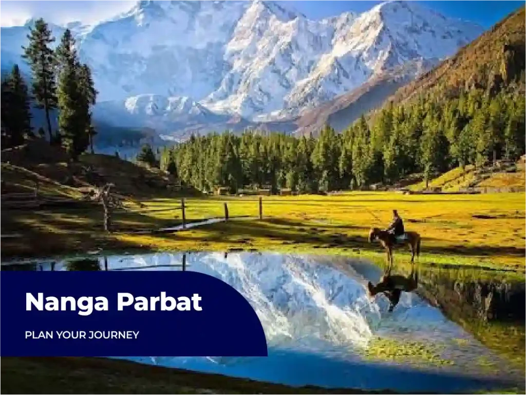
The easiest way is Fairy Meadows. A jeep ride and a hike of a few hours take you to a green meadow with a front row view of the mountain.
Fairy Meadows: the classic viewpoint
Fairy Meadows sits at about 3,300 meters in the Diamer district, facing the Raikhot side. The trip starts at Raikot Bridge on the Karakoram Highway. A local 4×4 jeep climbs about 15 kilometers to Tattu village. From there, you walk roughly 5 kilometers through pine forest. Most people need 2.5 to 4 hours.
The jeep track is narrow and steep therefore experienced local drivers run it every day, and we only travel it in daylight. On our tours, guests walk the last stretch at their own pace. Porters and horses wait in Tattu if you’d rather not carry a pack.
For the best view, go early. A ridge about 15 to 20 minutes from camp gives an open look at the mountain. At sunrise, it catches pink and gold light. Our guides point out that the main summit stays partly hidden from the meadow, so you won’t see the highest point from here.
As of July 2026, a one way jeep costs about PKR 7,000 to 9,000 per vehicle, which seats four to six people. A basic independent trip runs roughly USD 60 to 110 per person for two to three days. Our complete Fairy Meadows guide covers the road, huts, packing list and costs.
Before you book, check the US State Department advisory. As of October 2026, it lists Pakistan at Level 3, Reconsider Travel, in an update dated June 2026. US citizens also need a visa. Our Pakistan visa guide for US citizens explains the e-visa steps.
The Nanga Parbat Base Camp trek
The Nanga Parbat Base Camp trek continues past Fairy Meadows to Beyal Camp, then on to a viewpoint near base camp on the Raikhot side. It adds a long day to your trip.
Beyal Camp lies about 2 to 3 hours beyond the meadow. The base camp viewpoint adds roughly 2 more hours each way. The trail isn’t technical, but it gets harder to follow past Beyal. Our guides recommend going with a guide.
Climbers use a different base camp for each face, so this isn’t the camp where Diamer Face expeditions stay. Weather turns fast at this height. Pack warm layers, even in summer.
Viewpoints along the Karakoram Highway
You can see Nanga Parbat from the Karakoram Highway without hiking at all. The best views come near Raikot Bridge and around Chilas, as long as the weather cooperates.
Clouds tend to build later in the day, so mornings usually work better. Our Karakoram Highway travel guide lists the best stops along the route. For ideas beyond the mountains, see our local operator’s guide to the 15 best places to visit in Pakistan.
Best Time to See Nanga Parbat
June to September gives the clearest views. The wider season runs from about April to October.
We’re near the end of the season now. As of October 2026, snow usually closes the Fairy Meadows jeep track and trail by late October or early November. It reopens around April. Here’s how the months compare:
- April to May: Green meadows and smaller crowds. Snow patches can still linger early on.
- June to September: Warm days and the clearest views. Huts fill fast, so book early.
- October: Golden pine forest and cold nights. An early snowfall can close the road with little warning.
- December to March: Closed to visitors.
Mornings are usually clear, and clouds build in the afternoon. Nights can drop close to freezing, even in July and August. Our group departures have run in April and May, so check the tour page for current dates.
Nanga Parbat has a heavy history, but you don’t need to climb it to feel its scale. Fairy Meadows puts you in front of it after a jeep ride and a hike. Start with our complete Fairy Meadows guide for the road, the huts and the costs. Then look at our Fairy Meadows tour. As of October 2026, the 5 day, 4 night trip from Islamabad starts at Rs 38,500 per person on triple sharing.
Frequently Asked Questions
How high is Nanga Parbat?
Nanga Parbat is 8,126 meters (26,660 feet) high. That makes it the ninth highest mountain in the world. Some older sources list 8,125 meters, so you may see both figures. It’s one of 14 peaks on Earth above 8,000 meters, and it anchors the western end of the Himalaya.
How many people have died on Nanga Parbat?
By most counts, about 70 to 85 climbers have died on Nanga Parbat. Thirty one of those deaths came before the first ascent in 1953. Counts vary because sources treat support staff differently. Roughly one climber has died for every five who reached the summit.
Is Nanga Parbat harder than Everest?
Most mountaineers say yes. Nanga Parbat is lower than Everest, which stands 8,849 meters tall. But it has steeper walls, more avalanche risk and almost no commercial support. Everest has fixed ropes and large guiding teams. Nanga Parbat doesn’t, so climbers need more technical skill.
Can tourists visit Nanga Parbat?
Yes, but not to climb it. Climbing takes expedition permits and serious experience. Tourists can see the mountain from Fairy Meadows after a jeep ride and a hike, with no climbing skills needed. Check the US State Department advisory first, and book with a licensed local operator.
Where is the best view of Nanga Parbat?
Fairy Meadows gives the classic view, facing the Raikhot side. For a closer look, hike on to Beyal Camp. You can also see the mountain from the Karakoram Highway near Raikot Bridge and Chilas. The Rupal side offers a very different view, but it takes longer to reach.
What does Nanga Parbat mean?
Nanga Parbat comes from Sanskrit words that mean “naked mountain.” The name refers to its south side, which is often bare of snow. Locals also call the peak Diamer, from a Shina phrase meaning “huge mountain.” Shina is a language spoken across the area.

Eagles Adventure is a leading travel company in Pakistan, providing domestic, international, and Umrah tours with exceptional safety, comfort, and memorable experiences.