
Key Takeaways
- The Karakoram Highway is also known as the KKH and N 35 National Highway. It links Pakistan with China through the Khunjerab Pass.
- The Pakistan section is roughly 800 to 887 km, depending on how the route is measured. The full highway continues to Kashgar in China and is about 1,300 km long.
- The most popular tourist route runs from Islamabad through Besham, Chilas, Gilgit, Hunza, Passu, Sost and Khunjerab Pass.
- Road conditions can change quickly because of rain, landslides, falling rocks and road work. Check current conditions before setting out.
- Allow at least 7 days for a comfortable road trip. A longer trip gives you more time for Hunza, Fairy Meadows, Skardu and other northern destinations.
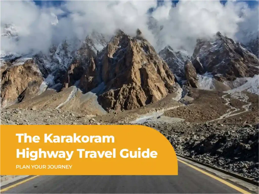
The Karakoram Highway is one of the most remarkable road journeys in Pakistan. It connects Hasan Abdal with Khunjerab Pass and continues into China. Along the way, the road passes through Besham, Chilas, Gilgit, Hunza, Passu, and Sost. You also get views of some of the highest mountains in the region.
For US travelers, the KKH offers a very different kind of road trip. The journey is not only about reaching a destination. The road itself is the experience.
You can follow the Indus River through deep valleys, stop at viewpoints, explore Hunza, see Attabad Lake, and continue towards the China border at Khunjerab Pass.
This guide covers the Karakoram Highway route, road conditions, major stops, the best time to visit, and practical ways to plan the journey.
What Is the Karakoram Highway?
The Karakoram Highway is an international road connecting Pakistan and China. In Pakistan, it is designated as N 35. The highway starts at Hasan Abdal in Punjab and runs north through Khyber Pakhtunkhwa and Gilgit-Baltistan before reaching Khunjerab Pass. From there, it continues into China.
It is often called the China-Pakistan Friendship Highway. The road was built jointly by Pakistan and China and opened to the public in 1986. Construction took many years because of the difficult mountain terrain.
The highway crosses a landscape shaped by three major mountain systems: the Karakoram, Himalaya, and Hindu Kush. This is one reason the journey feels so different from a normal highway trip.
The road also follows sections of an old trading route connected with the Silk Road. Today, it carries tourists, local traffic and commercial vehicles between Pakistan and China.
The name “Eighth Wonder of the World” is not an official title. It is a popular description used for the highway because of the terrain, engineering work, and scale of the project. National Geographic has also described it as the highest paved international road in the world.
Why Is the KKH Worth Visiting?
The biggest reason is variety.
The scenery changes throughout the journey. Near the lower sections, you’ll see rivers, green valleys, and populated towns. Further north, the landscape becomes much more rugged.
Near Chilas, Nanga Parbat can dominate the view. Around Gilgit, the valley opens up. As you enter Hunza, huge peaks rise above villages and orchards.
Further north, you’ll reach Attabad Lake, Passu and Sost. The final climb to Khunjerab Pass takes you into a much colder and higher landscape.
You don’t need to be a serious trekker to enjoy the route. Most of the major sights are accessible by road.
Karakoram Highway Route and Map
The classic Karakoram Highway route for tourists starts around Islamabad and continues north to Khunjerab Pass.
A practical route looks like this:
Islamabad → Besham → Chilas → Gilgit → Hunza → Attabad Lake → Passu → Sost → Khunjerab Pass
The exact driving distance varies by starting point and route. Pakistan’s National Assembly has listed the N 35 section from Hasan Abdal to Khunjerab at 806 km, while broader references place the Pakistan section at about 887 km.
For planning purposes, focus less on one exact distance and more on your overnight stops.
Islamabad to Besham
The journey begins in the Islamabad area before moving north towards Abbottabad and Mansehra. The road becomes more mountainous as you continue towards Besham. This is where the character of the trip starts to change.
Besham is a useful overnight stop or break point for travelers continuing towards Chilas.
Don’t try to cover too much distance on the first day. Long mountain drives can take more time than expected because of traffic, road work, and weather.
Besham to Chilas and the Nanga Parbat Viewpoint
The road from Besham towards Chilas is one of the more dramatic sections of the journey. The route follows the Indus River through mountain valleys. You’ll pass rocky slopes, narrow sections, and large cliffs.
Chilas is an important stop before you continue towards Gilgit.
One of the major highlights is the view towards Nanga Parbat. The mountain rises to 8,126 meters and is one of Pakistan’s most famous peaks.
The Raikot Bridge area also provides access to Fairy Meadows. If you want to include Fairy Meadows, plan extra time instead of trying to fit it into an already packed driving day.
Gilgit to Hunza
From Gilgit, the road continues north towards Hunza.
This is one of the most scenic parts of the KKH. You’ll see mountain villages, rivers, orchards and massive peaks.
Rakaposhi is one of the major highlights along this section. The Rakaposhi viewpoint near Ghulmet is a popular place to stop, have tea, and take photographs.
Once you reach Hunza, slow down.
Karimabad is a good base for exploring the valley. You can visit historic forts, viewpoints, and local villages without spending the whole day in the vehicle.
Hunza to Khunjerab Pass
The road becomes even more scenic after Hunza.
You’ll pass Attabad Lake before reaching Gulmit and Passu. From Passu, the famous Passu Cones become one of the main sights.
The road then continues towards Sost, the last major settlement before Khunjerab Pass.
From Sost, the highway climbs steadily towards the border.
Khunjerab Pass sits at about 4,693 meters. It is the highest point of the Karakoram Highway and one of the world’s highest paved international border crossings.
Is the Karakoram Highway Dangerous? Road Conditions Today
The Karakoram Highway isn’t a road you should treat casually. It is also not a road that you need to fear if you plan properly.
Road conditions vary by section. Some parts are smooth and easy to drive. Other sections can be narrow, rough, or affected by rockfall and landslides.
Rain can make mountain roads more difficult. The National Highway and Motorway Police advise travelers to check weather and road conditions before heading towards northern areas, especially during heavy rain.
Road work can also affect travel times. Current conditions should be checked shortly before departure rather than relying on an old travel report.
Should You Drive at Night?
We don’t recommend night driving on unfamiliar mountain sections.
Daylight gives you better visibility and more time to react to traffic, rocks, road damage, or other hazards.
It also makes the journey much more enjoyable. Many of the best views along the KKH are easy to miss after dark.
What About Landslides?
Landslides are one of the main things to keep in mind.
Heavy rain can loosen rocks and soil on steep slopes. Falling rocks can also affect the road.
This doesn’t mean you should cancel your trip every time rain is forecast. It does mean you should build some flexibility into your itinerary.
If a road is temporarily blocked, your driver or tour operator can help you decide whether to wait or adjust the route.
The National Highway and Motorway Police specifically advises travelers to check road conditions before northern trips and warns about landslides and falling rocks in hilly areas.
Practical Safety Tips
- Travel during daylight whenever possible.
- Check weather and road conditions before leaving.
- Keep some extra time in your schedule.
- Carry your passport if you’re traveling towards Khunjerab Pass.
- Keep water and snacks in the vehicle.
- Don’t stop in unsafe locations for photographs.
- Follow instructions at checkpoints.
- Listen to your local driver or guide when conditions change.
Best Stops Along the KKH
The Karakoram Highway has many viewpoints and villages worth stopping for. If you rush from one city to another, you’ll miss much of what makes the route special.
Rakaposhi Viewpoint
Rakaposhi is one of the first major mountain sights you’ll encounter after Gilgit.
The viewpoint near Ghulmet gives you a clear view towards the massive peak. At 7,788 meters, Rakaposhi towers above the surrounding landscape.
It’s an easy stop to add to a road trip.
Give yourself enough time for tea, photographs, and a short break instead of treating it as a quick roadside photo stop.
Attabad Lake
Attabad Lake is one of the most recognizable sights on the Karakoram Highway.
The lake formed after a massive landslide in 2010 blocked the Hunza River. The resulting lake changed the route of the highway.
Today, travelers pass through tunnels built as part of the road realignment around the lake. The turquoise water and steep mountains make this one of the most memorable sections of the journey.
If conditions allow, you can also spend time near the lake and enjoy the views instead of only driving past it.
Passu Cones and Hussaini Bridge
Passu is one of the most photographed areas along the KKH.
The sharp Passu Cones rise above the valley and are easy to spot from the road. The nearby village also provides a good base for exploring Upper Hunza.
The Hussaini Suspension Bridge is another well-known attraction in the area.
If you don’t enjoy heights, you don’t need to cross it. The surrounding landscape is worth seeing on its own.
The official Gilgit-Baltistan tourism material also highlights Passu for its views of the Passu Cones, Passu Glacier, and Batura Glacier.
Khunjerab Pass, the Top of the Journey
Khunjerab Pass is the natural end point for most KKH road trips in Pakistan.
At about 4,693 meters, the pass sits high above the valleys below. The landscape is much more open and barren than Hunza.
The temperature can also be much lower than in the valleys.
Take warm layers even if the weather feels pleasant in Hunza. Conditions can change quickly at this elevation.
Lonely Planet’s guide to the best road trips in Pakistan also recommends the Karakoram Highway as one of Pakistan’s major road trip routes.
Best Time for a Karakoram Highway Road Trip
The best time for a Karakoram Highway Road trip depends on how far north you want to travel.
For most travelers, late spring through early autumn offers the easiest conditions for exploring the northern areas. April through October is generally considered a good period for the mountains, although weather can still affect individual sections.
May and June
These months offer pleasant conditions in many parts of the route.
Hunza becomes especially attractive as the valley turns green and fruit trees come into season.
Higher areas can still be cold, so pack layers.
July and August
These are popular travel months.
The valleys are lively, and many domestic travelers visit northern Pakistan during this period.
However, summer rain can create road problems in some areas. Heavy rain can increase the risk of landslides and falling rocks.
If you’re traveling during these months, don’t make every day dependent on reaching a destination at an exact time.
September and October
These can be excellent months for the KKH.
The weather is often cooler, the mountains can have clear views, and Hunza takes on autumn colors later in the season.
Crowds may also be lower than during peak summer.
Winter
Winter travel is possible on parts of the highway, but conditions become more demanding as you move towards Khunjerab.
The border situation can also change by season and weather. Always confirm current border arrangements before planning a Pakistan to China crossing.
How to Travel the KKH: Self-Drive, Bus or Guided Tour
There are three main ways to experience the highway.
Self-Drive
Self-driving gives you more control over your schedule.
However, it also puts the responsibility for navigation, road conditions, vehicle handling, and unexpected delays on you.
If you’re visiting Pakistan for the first time, mountain driving may feel very different from driving in the United States.
An experienced local driver can also help with checkpoints, local road conditions, and route changes.
Bus
Buses are an option for travelers who want a lower-cost way to move between major towns.
The downside is flexibility.
You can’t always stop at a viewpoint when you want to. Travel times can also change because of road conditions.
Guided Tour
A guided Karakoram Highway tour is often the easiest choice for international visitors.
A local operator can handle transport, accommodation, and the route. The guide can also help when plans change because of weather or road conditions.
At Eagles Adventure, our focus is on organized travel across Pakistan, with domestic tours designed around comfort and practical planning. The company has operated since 2014 and holds a DTS license.
For travelers who want to explore more of Pakistan beyond the KKH, see our domestic tours in Pakistan.
Suggested 7 to 10 Day KKH Itinerary
You can drive the Karakoram Highway faster, but 7 to 10 days gives you more time to enjoy the major stops.
| Day | Route | Suggested plan |
| Day 1 | Islamabad to Besham | Begin the mountain journey and stay overnight |
| Day 2 | Besham to Chilas | Follow the Indus River and reach Chilas |
| Day 3 | Chilas to Gilgit | Stop for mountain views and continue to Gilgit |
| Day 4 | Gilgit to Hunza | Visit Rakaposhi viewpoint and explore Hunza |
| Day 5 | Hunza | Spend a full day exploring the valley |
| Day 6 | Hunza to Passu | Visit Attabad Lake and continue to Passu |
| Day 7 | Passu to Khunjerab | Visit Sost and Khunjerab Pass |
| Day 8 | Return towards Hunza | Travel back with time for stops |
| Day 9 | Hunza to Chilas | Begin the southbound journey |
| Day 10 | Chilas to Islamabad | Complete the road trip |
This itinerary can change depending on road conditions and your starting point.
If you have only 7 days, reduce the number of long stops. If you have 10 days or more, add time in Hunza or include a side trip to Fairy Meadows or Skardu.
For travelers who want a ready-made group experience, see the Eagles Adventure group tours available on the website.
Crossing Into China at Khunjerab, Border Basics
Reaching Khunjerab Pass doesn’t automatically mean you can cross into China.
The border crossing involves immigration and customs procedures. Entry rules can change, especially for foreign travelers.
Your passport and any required visa or travel documents should be in order before you leave.
Don’t plan a China crossing based only on a general travel blog. Confirm the current requirements with the relevant authorities or your tour operator before the trip.
The Karakoram Highway continues from Khunjerab into China’s Xinjiang region. The Pakistan section ends at the border, while the full international highway continues towards Kashgar.
If you’re only visiting Khunjerab as a tourist attraction, make that clear when planning your transport and itinerary.
What Makes the KKH Different From Other Road Trips?
The scale is the biggest difference.
On a normal road trip, you might drive through one type of landscape for several hours.
On the Karakoram Highway, the scenery can change dramatically within the same day.
You can start near the plains and finish at a high mountain pass. You can travel beside the Indus River, enter narrow mountain valleys, pass glaciers and reach villages surrounded by peaks.
The road also connects several major travel destinations. A KKH journey can easily become the backbone of a larger Pakistan trip.
You can combine it with Hunza, Fairy Meadows or Skardu instead of treating the highway as a separate attraction.
For a deeper look at one of the main destinations on the route, read our recent Hunza Valley travel guide.
Frequently Asked Questions
How long is the Karakoram Highway?
The full Karakoram Highway is about 1,300 km from Hasan Abdal in Pakistan to Kashgar in China. The Pakistan section is roughly 806 to 887 km, depending on the measurement used. For a tourist road trip from Islamabad to Khunjerab, plan for several days rather than trying to cover the distance quickly.
Can tourists drive the Karakoram Highway themselves?
Yes, experienced travelers can drive the KKH themselves. However, mountain driving requires extra care, especially on unfamiliar sections. First-time visitors may find a local driver or guided tour easier. A local driver can also help with changing road conditions, checkpoints, and route decisions.
Is the KKH fully paved?
The main Karakoram Highway is a paved road, but conditions aren’t identical along the entire route. Weather, road work, rockfall, and landslides can affect individual sections. Travelers should check current conditions before departure and allow extra time for unexpected delays.
What is the highest point on the Karakoram Highway?
The highest point is Khunjerab Pass, which sits at about 4,693 meters above sea level. It is also the highest point of the highway and one of the world’s highest paved international border crossings. Temperatures at the pass can be much colder than in Hunza or Gilgit.
How many days do you need for the KKH?
For a road trip from Islamabad to Khunjerab and back, 7 to 10 days is a practical starting point. A shorter trip is possible if you focus only on major stops. Ten days or more gives you better flexibility and time to explore Hunza, Passu, and other northern destinations.
Can you ride a motorcycle on the KKH?
Yes, experienced motorcyclists can ride the Karakoram Highway. However, the journey requires careful planning because of long driving days, changing weather, mountain roads, and possible road hazards. Riders should have suitable experience and confirm current road and travel conditions before starting. Lonely Planet has also covered motorcycle travel along the KKH and recommends caution on Pakistan’s mountain roads.
Final Planning Tips
The Karakoram Highway rewards travelers who leave room for the unexpected.
Don’t build your entire trip around exact driving times. Mountain roads can take longer than expected.
Give yourself time to stop.
The viewpoints around Rakaposhi, Attabad Lake, and Passu are part of the journey, not just quick photo stops.
Check road conditions before each major driving day. The National Highway and Motorway Police provide travel advisories for major roads, while weather conditions can change quickly in northern Pakistan.
If you’re traveling from the United States, consider using a local operator for the mountain sections. It can make the trip easier, especially if you’re unfamiliar with Pakistan’s roads and local travel arrangements.
Most importantly, don’t rush the KKH.
The highway is worth experiencing slowly. Spend time in Hunza. Stop at the viewpoints. Look beyond the road itself.
That’s where the Karakoram Highway becomes more than a route between Islamabad and Khunjerab Pass. It becomes one of the main experiences of traveling through northern Pakistan.

Eagles Adventure is a leading travel company in Pakistan, providing domestic, international, and Umrah tours with exceptional safety, comfort, and memorable experiences.